Last Updated: March, 2026
Philadelphia SPB (9N2)Contact: Rob Dant (advocate) Phone: 484 301 0879.
My Forecast Tide Table | NOAA Tide Table
N39-51.54; W075-17.98. Elevation: 0. TPA: 250 msl.
Sealane: 11-29 9100 x 250, fresh wtr, rgt tfc rwy 11.
CTAF 122.9 (unmonitored)
More base info available at AirNav.com
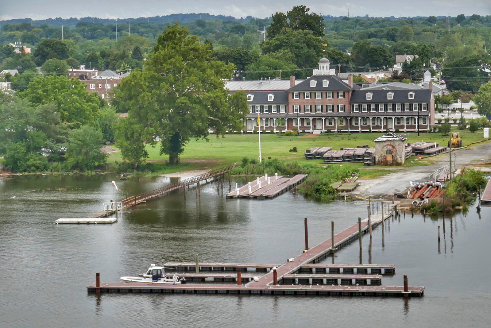
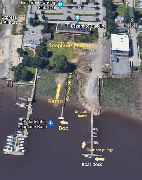
Floating Docks / Gravel Ramp
A new walkway extends to floating docks that are installed seasonally. As of 2025, the final configuration is not complete and temporary pilings may be installed. The gravel ramp (left of dock) is usable at high tide +/- 3 hours. New pavers are installed (2026) near the top to help with ramping. The water line reaches the pavers at mid-tide. River material washes up every day with the tide, making the ramp unusable without cleanup.
Water Condition:
The Delaware River at Essington is considered fresh water according to the Delaware River Basin Commission which monitors the brackish salt line (defined as > 0.25 gram/liter = 250ppm = 0.025%). The median brackish line is between the Delaware Memorial Bridge and the Commodore Barry Bridge, 8-10 miles south of the base. The Oct 2014 drought was just south of the Commodore Barry Bridge, 4 miles south of the base. During very extreme drought, the river can become brackish at Essington.
Spotting the base from the air:
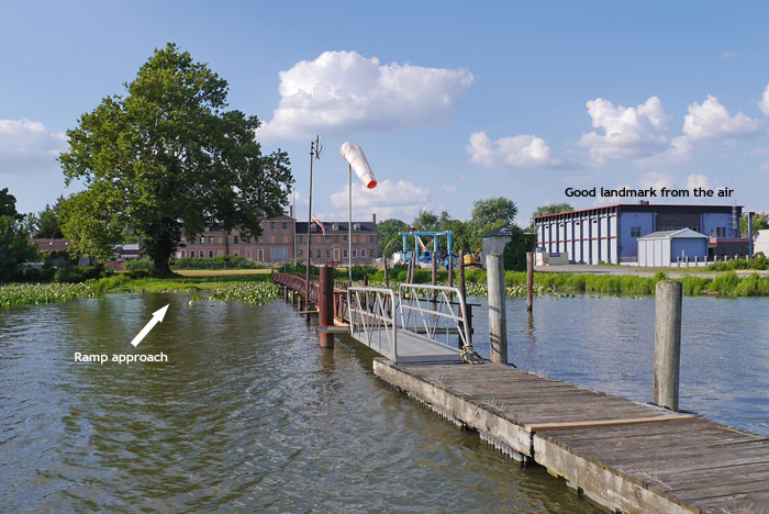
The best landmark is the large, boxy, medium blue industrial building next door to the east. The seaplane base is adjacent, west, in front of the big Lazaretto house.
Approach:
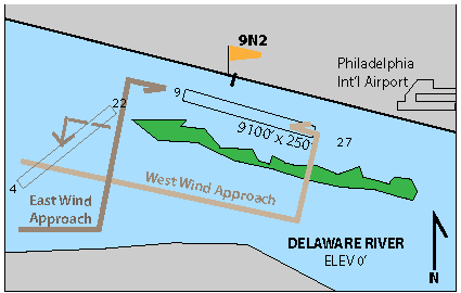
The typical approach to 9N2 is from and underneath the west side of Class B. The approach cutout ceiling is 600 feet and the sea lane is 300 feet.
WEST WINDS: The sea lane is north of Tinicum Island with a 300 ft ceiling See 1953 Sea Lane diagram signed by C.A.A. and Bob Mills). We typically fly down the south side of the island, eastbound at 250 ft. Turn base by mid-island, fly over the island and land to the west. Any farther east and you are entering Class B. Jet traffic climbing out of runway 27 Left is at a good altitude by that point and wake turbulence isn’t an issue.
EAST WINDS: This approach is easier, but jets landing runway 9 right present a wake turbulence concern. Fly down the south (NJ) side of the river, then turn right base in order to see the approaching jets from the west. If timing doesn’t look good, then fly westbound again and come around for another approach.
NORTH/SOUTH WINDS: Not a typical approach, but Bob Mills charted a runway 4/22 from Chester Island to the west end of Little Tinicum Island. Watch for large boat wake and obstacles near the tip of Little Tinicum Island.
Generally, land into the wind without regards to tidal flow.
Watch approach videos:
Approach Video (loud)
Rob Robertson’s excellent video flying in.
Air Traffic Control:
For decades, the Mills family operated here without radios or transponders, flying a 250 foot pattern, without any conflict with traffic at PHL. But, modern tech makes seaplanes more visible to ATC. The sea lane appears to be drawn inside the Class B surface area, but our belief is that the 300 foot shelf was originally drawn to allow seaplanes and helicopters to operate here without contact with ATC. Regardless, pilots are advised, for the moment (circa 2025) to request Class B clearance inbound from either approach (119.75, 124.35) or west tower (135.1). On departure, contact same, or if unable from the water, try Clearance at 1-800-354-9884. For special events, Philadelphia ATC Operations Desk can be alerted in advance at 215 492 4123.
Approaching Dock:
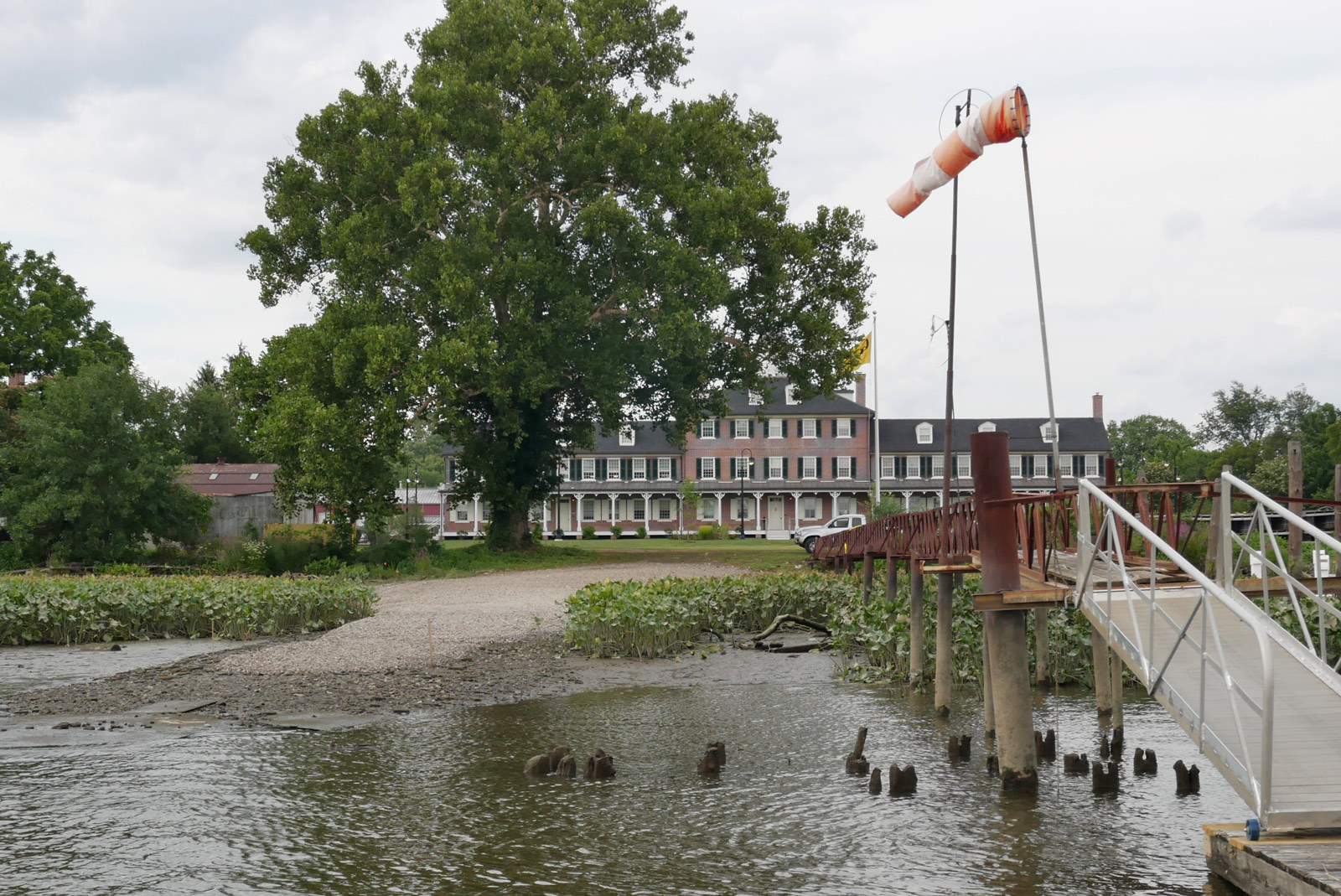
Approaching the floating dock, river flow may be important. At its highest rate, the river may flow up to 5 mph. There is (usually) a windsock on the stationary walkway leading to the floating dock.
Gravel Ramp:
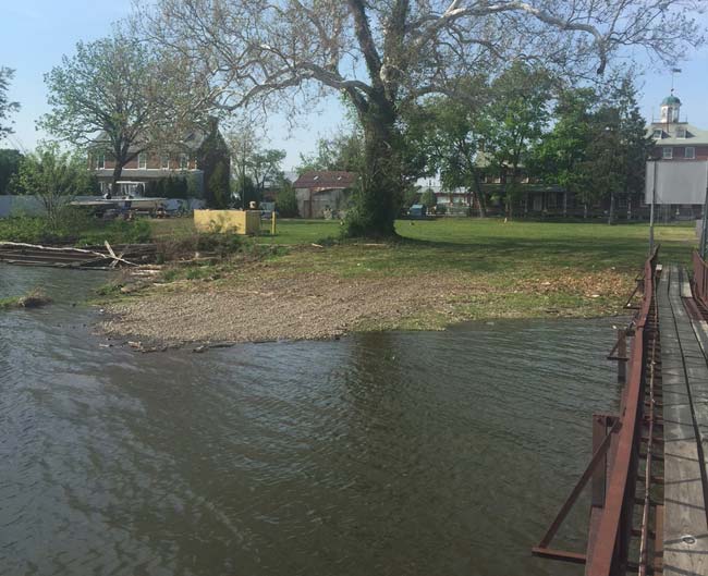
The gravel ramp is to the left as you approach the floating dock, between the big Sycamore and the walkway. There is a 6-foot tide here that washes debris onto the ramp twice a day, making it unusable except on days where it has been mowed and cleared of debris. Approach at a slight angle. The distance between the tree and the walkway is about 44 ft. The flagpole and tree are 52+ feet. The ramp is in good shape at high tide +/- 3 hours, but may be unusable at lower tides due to mud, bricks and metal plates at low tide.
Ramp at high tide:
Ramp at low tide 2021:
Splash In:
We could fit 12+ seaplanes on the grass and a couple at the floating dock.